Trip notes · Colorado
The Foxton run on the North Fork of the South Platte
The North Fork of the South Platte runs beside a county road through a pine-and-granite canyon southwest of Denver. The Foxton stretch is the classic Front Range after-work run for packrafters stepping up to Class III.
Last checked November 2026
Most Front Range creeks are too low to float by mid-July. The North Fork of the South Platte keeps going because Denver Water moves West Slope water through the Roberts Tunnel from Dillon Reservoir into the upper river and sends it downstream toward its intakes. That diversion keeps the North Fork running through much of the summer, often at a level that suits a packraft well. Below Buffalo Creek the river drops through a narrow, wooded canyon with County Road 96 beside it the whole way, and that reach is what paddlers mean by the Foxton run.
Route overview
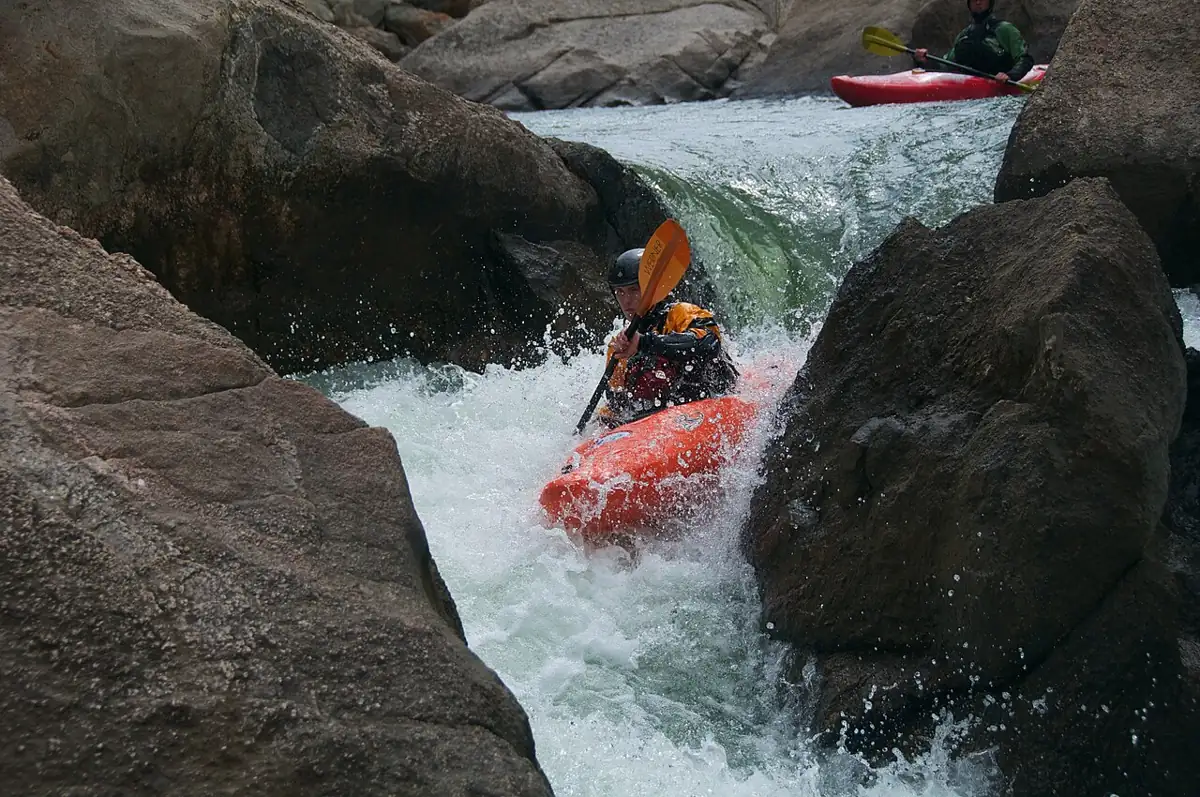
The run splits into three parts. The top two miles or so start near Ferndale, a couple of miles below Buffalo Creek, and include the boulder garden: a field of granite with steeper drops than anything else on the run. Paddlers who have run it describe the lines as fairly clear but the gradient as approaching Class IV, with more chances to pin a boat than lower down. Below the boulder garden the river mellows for a while.
The middle section, around the junction of County Roads 96 and 97, holds most of the Class II-III rock gardens and small ledges. The lower mile or two opens out and slows down before the North Fork meets the main South Platte at the old railroad town of South Platte.
| Segment | Approx. miles | Character | Who it suits |
|---|---|---|---|
| Upper put-in to below the boulder garden | 2 to 3 | Steeper, Class III+ to IV-ish, pin spots | Confident Class III packrafters with straps |
| Boulder garden to 96/97 junction | 2 to 3 | Easier Class II-III, some flat stretches | Most packrafters stepping up from Class II |
| 96/97 junction to the confluence | about 5.5 | Rock gardens, small ledges, calmer last mile | The usual packraft day |
These mileages follow American Whitewater's description of the reach and the road access, so treat them as approximate. Because the road is always close, you can cut the run to whatever length you want.
Getting there
The canyon is about 45 miles southwest of downtown Denver. You can reach it two ways: up US 285 past Conifer and down Foxton Road (County Road 97), or south through Sedalia on Highway 67 and across to the 96/97 junction. Both routes end at the same small cluster of road junctions in the canyon.
There are several put-ins. The upper ones near Ferndale sit above the boulder field, which is the most serious water on the run and is often called Class IV. Many packrafters start lower, at the large pullout near the junction of County Roads 96 and 97, which skips the boulder field and leaves about five and a half miles of Class II-III to the confluence with the South Fork. Take out wherever the road lets you park safely.
Land and access etiquette
Much of the riverbank is private. You will see plenty of no-trespassing signs, and the put-ins people use change over time. Pick a launch spot that is not posted and has room to park off the road. The shuttle roads are dirt, rough in places and dusty in summer, so allow extra time. Near the confluence you are on Pike National Forest and Denver Water land, and the Forest Service runs the camping and picnic sites along the main river there. Denver Water's own recreation notes say kayaking is fine on the North Fork but advise against canoes and inflatables near its property downstream, which is one more reason to finish at or above the confluence.
Flows and season
Paddlers here check one of two gauges. American Whitewater references the state gauge on the North Fork at Bailey, upstream of the canyon. The USGS gauge on the North Fork South Platte below Geneva Creek at Grant (06706000) sits even higher in the drainage and is useful for seeing when diversion water arrives. Neither one measures the run directly, so compare the number with recent trip reports.
As a rough guide, reports describe the upper run as scrapy but floatable down to around 180 to 220 cfs, and one 2016 report rated the boulder garden excellent at about 220. Trip reports describe the run as comfortable for packrafts at around 300 cfs, with rocks exposed but plenty of routes. American Whitewater rates the run Class IV above about 600 cfs. At higher flows the rapids get pushier and the eddies shrink, and a light boat has less room to fix a mistake. If the number is new to you, read how to use flows and gauges before you go, and compare with recent reports.
| Flow at the gauge (approx.) | What to expect in a packraft |
|---|---|
| Under about 180 cfs | Bony; frequent scraping, bumping and walking |
| About 200 to 350 cfs | The usual packraft range: technical, rocks visible, plenty of eddies |
| About 350 to 600 cfs | Pushier, fewer eddies, longer swims |
| Over about 600 cfs | Rated Class IV; for strong whitewater boaters only |
The season depends on the Roberts Tunnel. Snowmelt can bring the river up in late spring, but the steady summer flows come from diverted water, and those depend on how Denver Water runs its system that year. A dry year can mean an early end to the season. In years when the diversions keep running, early fall can be a good time to go, with cooler days.
The run
From the 96/97 junction, the first half mile is easy. Then the river narrows around a couple of bends and the rapids start: mostly Class II and III rock gardens and small drops, with perhaps five that most groups stop to look at. The road on river left makes scouting easy. It also brings traffic, so watch out when you walk the shoulder in a helmet and PFD.
A play hole near the 96/97 junction is a good place to practice ferries and surfing in a strapped boat. Above Dome Rock, a longer rapid with several small ledges and holes is the one that most often flips packrafts, especially at low water when a rock catches a tube at a bad angle. Paddlers who swim here tend to lose paddles, so keep a spare breakdown paddle in the group.
The last mile opens up and calms down before the confluence. On a summer weekend you will share the water with anglers, so give them room and pass on the far side when you can.
Hazards
- Granite sits just under the surface at moderate flows. A packraft bounces off rocks better than a hardshell does, yet a boat that hits one sideways can still wrap, so lean into the rock rather than away from it.
- At low flows rocks show up with little warning, and a tube that catches one at speed can spin or flip you. Keep your angle and read ahead.
- Trees fall into the channel after storms and spring runoff. Look for fresh strainers on each scout.
- Scouting from the road means walking a narrow shoulder with blind bends. Wear something bright.
- The diverted water comes from a high reservoir and stays cold well into summer. The page on cold water safety explains what a sudden swim does to your breathing.
Packraft setup and skills
- A whitewater packraft with thigh straps makes the Class III moves much easier. An open boat without straps will work at low flows but leaves little margin. If you are setting up straps for the first time, the guide to thigh straps and backbands covers fit.
- Wear a helmet. The rocks are granite and close to the surface at moderate flows.
- Carry a throw bag, and paddle with at least one other boat.
- The water is cold even in July. Dress for a swim.
For the strokes and boat angles that matter in rock gardens, see reading whitewater.
This run suits a packrafter who can catch eddies on demand, ferry across a current, and has practiced getting back into the boat in moving water. If you have only floated flatwater so far, the road makes Foxton a forgiving classroom, but go with someone who knows the river and walk anything that worries you. Working through core paddle strokes on a lake first makes the rock gardens far less stressful.
A sample after-work run
- Check the Bailey gauge at lunchtime and compare with recent reports. If it is far above the usual range, pick another evening.
- Drive down Foxton Road and leave a shuttle car at a legal pullout near the confluence end.
- Drive back up to the 96/97 junction pullout, inflate, and do a quick safety talk: signals, order of boats, who carries the throw bag.
- Paddle the first easy half mile as a warm-up, then scout the bigger rock gardens from the road as needed.
- Take out above the confluence, deflate on the bank, and keep wet gear in a separate bag for the drive home.
With two cars and a group that knows the river, the whole thing fits into a long summer evening. Allow more time on your first trip, because finding legal parking takes longer than paddling.
Easier water nearby
If the Foxton run feels like too much, the South Platte below Deckers has Class I-II floating in a scenic canyon. It is popular with tubers and anglers in summer, so pick a weekday.
More Colorado day trips are on the Colorado trips page. When you are ready for something longer, Browns Canyon on the Arkansas is the next step in whitewater, and Ruby-Horsethief Canyon is the gentle overnight option.
Foxton run FAQ
Do I need a permit to packraft the Foxton run?
No river permit is required. You do need to respect private land, park legally and follow Forest Service rules where the bank is national forest.
Which gauge should I check?
Most paddlers use the North Fork gauge at Bailey, with the USGS gauge at Grant (06706000) as a second reference. Neither sits on the run itself, so compare the reading with recent trip reports.
Is the Foxton run good for a first whitewater trip?
The lower section from the 96/97 junction is a reasonable first Class II-III run if you go with experienced paddlers and walk anything you are unsure about. The upper boulder garden is not a beginner rapid.
When does the run have water?
Usually from late spring into early fall, but summer flows depend on diversions through the Roberts Tunnel. Check the gauge rather than the calendar.
Can I continue below the confluence?
Not without planning for harder water. The main South Platte below the confluence steepens toward Strontia Springs Reservoir and is generally rated Class IV.