Trip notes · Colorado
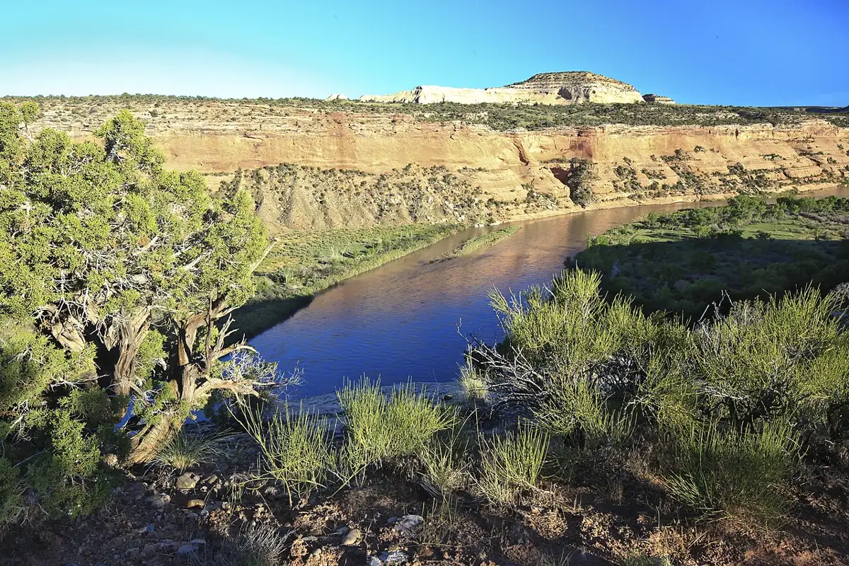
Ruby-Horsethief Canyon on the Colorado River
Ruby and Horsethief Canyons carry the Colorado River across the Utah line through red sandstone and black Precambrian rock. The water is mostly flat, which makes this the easiest overnight desert float in western Colorado.
Last checked November 2026
West of Grand Junction, the Colorado River leaves the farm valley at Loma and enters Horsethief Canyon, then Ruby Canyon, before reaching the Westwater ranger station just inside Utah. The trip is about 25 miles of Class I and easy Class II water, with railroad tracks following the river for much of the way and side canyons running into the McInnis Canyons National Conservation Area. A competent beginner in a packraft can do it in two days.
Route overview
Ruby-Horsethief is a one-way float with a single exit. Once you push off at Loma, the next public take-out is Westwater, roughly 25 river miles downstream. So whatever goes wrong, whether a sick paddler or a torn tube, gets dealt with on the river. There is no road to walk out to halfway down.
| Stretch | Approx. position | What you see |
|---|---|---|
| Loma launch to Horsethief Canyon | first few miles | Open valley, I-70 and farms fading behind you |
| Horsethief Canyon | upper third | Red sandstone walls, side canyons, the first designated camps |
| Black Rocks | about the middle | Dark, ancient rock, narrow channel, boils and eddy lines |
| Ruby Canyon | lower third | Wider river, tall red walls, the railroad on one bank |
| Westwater ranger station | end | Ramp, parking and the start of Westwater Canyon |
Twenty-five miles over two days leaves plenty of slack. Most groups float five to seven hours on the first day and leave time for a hike, or spread the trip over three days with a layover.
Permit and campsites
The BLM requires a camping permit for overnight trips year-round. Camping is limited to designated sites, each for one group per night, and you reserve them through Recreation.gov. The booking window opens a set period before your dates, and popular spring and fall weekends fill fast. Day trips do not need a permit. The official page is the BLM Ruby-Horsethief permit page.
Expect permit stipulations that include packing out human waste with a portable toilet system and using a fire pan if you have a fire. Read the current rules on your permit before you go.
Westwater Canyon, below the ranger station, needs its own permit and has Class III-IV rapids.
How booking works
Reservations open two months ahead on a daily rolling window, at 8 a.m. Mountain time, and you can book a multi-night trip within that window. Each person can hold only one active reservation at a time, though you can take several trips a year. Camping fees apply from April through October and scale with group size. From November through March you still need a permit, but only the reservation fee is charged. You can print the permit seven days before launch.
A few rules shape how you pick sites:
- You must camp at the site on your permit.
- Book your camps in downstream order. A night-two camp upstream of your night-one camp will not work.
- The Black Rocks sites allow only a single night on Fridays and Saturdays, and no layovers.
- Groups are capped at 25, and dogs count toward that total. A group can bring at most two dogs.
- If you cannot reach a camp you booked, you still have to continue to Westwater; there is no other exit.
The permit page lists a durable metal fire pan, at least about a foot across with a raised lip, among the required items, and you must carry it even if you plan to cook on a stove. Confirm the current human-waste rules on your permit; a sealed portable toilet system is standard practice on western desert rivers and is the safe assumption here.
- Two months before your launch date, log in to Recreation.gov at 8 a.m. Mountain time.
- Pick camps that fit your pace: about 10 to 15 river miles a day is comfortable for loaded packrafts.
- Check that each night's site is downstream of the last.
- Book a shuttle or arrange a second vehicle at Westwater.
- Print your permit in the final week and read the stipulations with your group.
The float
The Loma boat launch sits just off I-70, and the first miles run through open country before the walls close in at Horsethief Canyon. Around the middle of the trip you reach Black Rocks, where the river cuts through hard, dark Precambrian rock and the channel narrows. At higher flows the eddy lines and boils there can spin a packraft and occasionally flip one. At lower flows the Black Rocks camps are some of the most sought after on the trip, though the currents still deserve respect if you swim.
The BLM describes the Black Rocks as Vishnu schist about 1.7 billion years old, the same family of rock that lines the inner gorge of the Grand Canyon. Swimming from the ledges here is tempting on a hot afternoon, and it is where the river's strength is easiest to underestimate.
Below Black Rocks the river widens again through Ruby Canyon. Side canyons such as Mee, Knowles and Rattlesnake reach up toward the NCA's arches and the Kokopelli Trail. Many groups lay over a day to hike one.
Flows and season
The Colorado here is big water by packraft standards even when it looks lazy. Spring runoff usually peaks in late May or June. The water then is cold and fast, and the boils at Black Rocks are at their strongest. Summer flows are lower and warmer, but July and August bring heat, gnats and afternoon storms. The USGS gauge on the Colorado near the Colorado-Utah state line gives the current flow. If you are new to cfs numbers, read how gauges work and compare with recent trip reports.
That gauge, number 09163500, sits a short way above the state line and below the Gunnison River confluence at Grand Junction, so it reflects both rivers. Its readings are provisional until USGS publishes them. No single number tells you the trip is on. Watch the trend instead. A river rising quickly in May means stronger boils at Black Rocks and colder water, and a steady summer level means slower current, so the same miles take longer and leave you out in the afternoon wind.
| Season | Conditions | Packraft notes |
|---|---|---|
| April | Cool days, cold water, rising flows | Dress for immersion; fewer bugs |
| May to June | Peak runoff, fast current | Short paddling days; respect Black Rocks |
| July to August | Hot, lower flows, gnats and storms | Start at dawn; shade is scarce |
| September to October | Warm days, cool nights, steady flows | Prime season; book early |
| November to March | Cold, quiet, permit still required | Strong, well-equipped groups only |
Hazards
- Boils and whirlpools at Black Rocks at higher flows
- Strainers from cottonwood and tamarisk along the banks
- Freight trains on the riverside tracks, harmless on the water but loud at camps near the line
- No exit before Westwater, so a medical problem means a long float or an outside rescue
- Summer heat and thin shade, which make dehydration a real risk on a slow day
For spring trips, the page on cold water safety explains why a swim in runoff feels so different from a summer dip.
Packraft notes
A touring packraft with a spray deck or an open-deck boat suits this trip well. You do not need thigh straps for the rapids, but a longer, tracking hull makes flatwater miles easier. Pack heavy gear low or inside the tubes to reduce windage. The packing list covers most of what you need. Add a portable toilet and fire pan.
A light lake and backcountry packraft handles the water easily, though it is slower into a headwind. Strap gear in waterproof dry bags low on the bow rather than stacking it high. A spare paddle per group is worth the weight on a trip with no road access.
Who it suits
Ruby-Horsethief is a good first overnight river trip for packrafters who can paddle a straight line for several hours and handle a swim in moving water. It also suits families, anglers and groups mixing packrafts with canoes or rafts. If you bring a dog, read the notes on packrafting with a dog, since dogs count toward the group limit and the camps are shared ground.
Camp practices
Designated sites mean you camp where others camp every night of the season, so impact adds up fast. Use the fire pan, carry out ash, keep food away from wildlife (the permit page recently warned of a bear near Black Rocks and asked groups to use bear-safe containers), and pack out every scrap of trash. The basics are in the guide to leave no trace on rivers.
Shuttle
Westwater is reached by a road off I-70 in Utah. The drive back to Loma is short by desert standards, and local outfitters run vehicle shuttles.
If you run your own shuttle, leave one vehicle at Westwater before you launch and drive the second back to Loma. Give yourself time for that drive on launch morning so you are on the water before the wind comes up.
For a step up in whitewater, see Browns Canyon on the Arkansas. For a longer flatwater desert trip on another river, Labyrinth Canyon on the Green is the natural next trip. More Colorado options are on the Colorado trip notes page.
Ruby-Horsethief FAQ
Do I need a permit to float Ruby-Horsethief?
Only for overnight trips. The BLM requires a camping permit year-round for overnights, reserved on Recreation.gov. Day trips do not need one.
How far ahead can I book?
Two months, on a daily rolling window that opens at 8 a.m. Mountain time. Spring and fall weekends go quickly.
Can I take out before Westwater?
No. Westwater is the only take-out below Loma, so plan for the full 25 miles even if the weather turns.
Is Ruby-Horsethief suitable for a first packraft overnight?
Yes, for paddlers comfortable in moving water. The rapids are mild, but wind, cold spring water and the boils at Black Rocks need respect.
Can I continue into Westwater Canyon?
Only with a separate permit and Class III-IV skills. Westwater Canyon is a different trip with its own rules.