Trip notes · Utah
Packrafting Labyrinth Canyon on the Green River
Labyrinth Canyon is a long, quiet stretch of the Green River between the town of Green River and Canyonlands. It has no rapids, tall walls and a free BLM permit, which makes it the easiest multi-day desert trip a packrafter can plan. The hard parts are the distance, the afternoon wind and the dirt road at the take-out.
Last checked November 2026
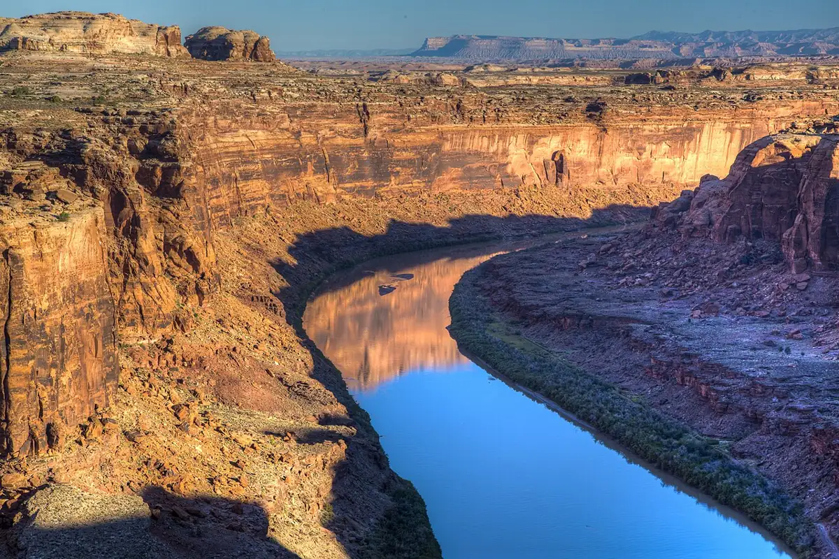
From the town of Green River, Utah, the Green loops south through sandstone meanders for about 68 river miles before it reaches Mineral Bottom and the Canyonlands National Park boundary. The lower part of that reach is Labyrinth Canyon, a deep, winding gorge with Wingate and Navajo sandstone walls and no rapids. In a packraft it is about as gentle as a multi-day river trip gets. It is also a long way to paddle a short, light boat, so the miles and the wind will shape your plan far more than any rapid will.
That makes Labyrinth a good first overnight river trip: you learn loading, camp routines, water management and a toilet system on water that will not punish a mistake. If you are new to small boats, the packrafting primer covers the basics first.
The route
The BLM permit for this section lists three launch points: Green River State Park, Crystal Geyser and Ruby Ranch. Green River State Park, in town, has a paved ramp and adds about 23 miles of open valley before the canyon walls rise. Crystal Geyser trims a few of those miles. Ruby Ranch, private land reached by dirt road, cuts the valley out; it charges a launch fee and opens sunrise to sunset, so confirm arrangements ahead.
Almost every group takes out at Mineral Bottom, a BLM boat ramp with a vault toilet. The road down to it leaves Utah Route 313 about 12 miles west of US 191 and runs roughly 16 miles of dirt before dropping off the rim on steep switchbacks. The BLM recommends four-wheel drive and high clearance, especially on the switchbacks and the last mile, and the road turns slick and impassable when wet. It has washed out before. Call the Moab Field Office about its condition before you book a shuttle.
Landmarks and mileage
| Stretch | Approx. river miles | What to expect |
|---|---|---|
| Green River State Park to Ruby Ranch | about 23 | Open valley, mostly private land |
| Bowknot Bend loop | about 7 around the loop | River nearly doubles back on itself |
| Ruby Ranch to Mineral Bottom | about 45 | The standard packraft trip |
| Green River to Mineral Bottom | about 68 | The full Labyrinth float |
Below Ruby Ranch, most of the land is state or federal; above it, much of the bank is private, so plan your first camp below the ranch if you launch in town. Trin-Alcove Bend is where three side canyons meet the river, and they make a good first-afternoon walk. At Bowknot Bend the river runs about seven miles around a loop and comes back to within a few hundred yards of itself.
Bowknot Bend: the packraft shortcut
A light boat gives you an option here that canoe groups rarely take. Instead of paddling the seven-mile loop, you can land at the upstream side of the saddle, deflate, carry everything over roughly a mile of steep, rocky slope with some route finding, and launch again on the far side. Budget two to three hours for the whole operation, including packing and reinflation. Harder trips around Utah involve plenty of carries like this one, so rehearse inflating your packraft at home first.
Permit and required gear
The BLM requires a permit for every non-commercial trip through Labyrinth Canyon, between Green River State Park and the Canyonlands boundary at Mineral Bottom. It is free and there is no lottery.
- Download the Labyrinth Canyon permit form from the BLM page.
- Fill in the trip leader (18 or older), group size (25 maximum), launch point, launch date and take-out date.
- Mark Mineral Bottom as your take-out, or mark that you are continuing into Canyonlands.
- Email the completed form to the Moab BLM address on the form, or leave a copy with an issuing official.
- Print a copy. The trip leader must carry it on the river.
- Read every stipulation, then pack the required toilet and fire pan.
By signing the form, the trip leader agrees to carry and use a fire pan and a portable toilet. Groups must also be self-contained: carry your own water, first-aid kit, pump and repair kit, and expect no cell service. Most packrafters use commercial waste bags inside a hard-sided, sealed container or a dedicated heavy dry bag, which is the kind of system Canyonlands and the San Juan stipulations accept. The official page is the BLM Labyrinth Canyon river page.
Utah state boating rules apply on the river. Carry a properly sized Type I, III or V life jacket. Inflatable PFDs are not accepted on Utah river permits, so a packrafter's usual foam vest is the right choice. The life jacket guide explains the labels.
Continuing past Mineral Bottom
Below Mineral Bottom the river enters Canyonlands National Park as Stillwater Canyon, about 52 to 54 more miles to the confluence with the Colorado. That needs a separate National Park Service permit, reserved through Recreation.gov up to four months ahead, with a reservation fee and a per-person fee. The park permit covers the nights you spend below Mineral Bottom; your Labyrinth nights stay on the BLM form. No roads reach the river near the confluence, so the standard finish is a pre-booked jet boat shuttle back upstream to Moab. Park rules add a rigid metal fire pan, driftwood-only fires and no pets, and Cataract Canyon's rapids start four miles below the confluence, so do not drift past your pickup.
Flows and season
The Green carries spring snowmelt from Wyoming and is partly regulated by Flaming Gorge Dam far upstream. Look at USGS gauge 09315000, Green River at Green River, Utah, before you go; the guide to river flows and gauges explains how to read it. Flows can range from a couple of thousand cfs in a dry autumn to well over ten thousand during a big runoff.
Spring flows give you a faster current and cold, silty water, but cover many sandbars, so camps get scarce. In late summer and fall the river slows and the bars widen. Ice can form from late fall to early spring.
Plan on 15 to 20 miles a day at high water and 10 to 15 at low water, which matches the NPS planning figures for the Green below Mineral Bottom.
Worked example: a 2-day Labyrinth float
Two days is the shortest sensible plan, and only from Ruby Ranch. It suits fit paddlers in spring, when the current does a good share of the work. At low autumn flows the same plan turns into two long days of hard paddling, so add a third day.
- Launch: Ruby Ranch, early on day one. Arrange the ranch fee and parking ahead.
- Distance: about 45 river miles, or about 38 if you carry over the Bowknot saddle.
- Day one: Paddle to somewhere past Trin-Alcove Bend, 20 to 24 miles, with the hardest work done before the afternoon wind.
- Day two: Bowknot carry if the wind is up, then on to Mineral Bottom with time left for the drive out.
- Shuttle: a commercial shuttle service moves your car to Mineral Bottom or meets you there. The BLM page lists permitted companies.
- Permit: the free BLM form, launch Ruby Ranch, take-out Mineral Bottom.
Worked example: a 4 to 5 day float
Most groups should plan this version. You can launch in town, walk up the side canyons, and still sit out a windy afternoon without falling behind.
| Day | Plan | Approx. miles |
|---|---|---|
| 1 | Green River State Park to a camp below Ruby Ranch | 23 to 27 |
| 2 | Into the canyon, afternoon hike at Trin-Alcove | 12 to 15 |
| 3 | Short day, explore side canyons, early camp | 8 to 12 |
| 4 | Bowknot Bend, hike the saddle, camp below | 10 to 12 |
| 5 | Out to Mineral Bottom, shuttle home | remaining miles |
Drop day three for a four-day trip. Launching from Ruby Ranch instead turns the same itinerary into a relaxed five days of 8 to 12 miles each.
Logistics. Book the shuttle first, because shuttles, not permits, are the limiting factor here, and check the Mineral Bottom road the week before.
Water. Carry at least a gallon per person per day, and more in heat. The Green is silty enough to clog a filter quickly, so let water settle overnight in a bucket or spare bag before you filter it.
Packing. The packrafting packing list covers this trip once you add a toilet kit and extra water capacity. Pack food and clothing in separate dry bags so a leak in one does not soak the other, and keep the toilet container on the outside where you can reach it.
Hazards
- Heat and sun. The walls reflect heat and midday shade is rare.
- Flash floods. Thunderstorms upstream can send debris-laden water down the side canyons. Do not camp in a side-canyon mouth.
- Mud. Banks at low water can be deep, sticky clay. Land on sand or rock where you can.
- Tamarisk. Dense thickets line many banks. They hide camps and snag gear, and you cannot climb out through them in a hurry.
- Cold water. Spring runoff is cold. A swim is unlikely on flatwater, but read up on cold-water safety if you plan an April trip.
Camping
Camps are undesignated. You pick a sandbar, bench or open beach, and spring high water can cover many of them, while low-water years expose more sand. Camp on durable sand, cook below the high-water line, and keep any fire in the pan. Follow Leave No Trace on rivers and leave the rock art and inscriptions in side alcoves alone.
Tie the boat down at night. Packrafts weigh almost nothing, and an evening gust will carry an empty one into the river.
Packraft notes
- Lash your pack low and centered on the bow, or stow gear inside the tubes if your boat has cargo zippers, to cut windage.
- A longer paddle and a boat with a defined stern or skeg track better on flat water. A whitewater boat with a self-bailing floor is a poor fit here, since the drain holes add drag and let water in without any rapids to justify them.
- A touring or ultralight packraft is the natural choice for this flatwater.
- An efficient forward stroke saves hours over 45 miles; see paddle strokes.
Who this trip suits
Labyrinth suits newer packrafters ready for a first overnight and anyone who wants a quiet canyon, provided they can paddle flatwater for six hours a day and run their own camp. For whitewater on the same river, look upstream at Desolation and Gray Canyons. The San Juan River is another permit trip that requires a toilet kit and has easy rapids. For a shorter flatwater float in Arizona, see the Glen Canyon stretch below the dam.
Common questions
Does Labyrinth Canyon need a permit?
Yes, the free BLM permit, emailed to the Moab office with a copy carried by the trip leader.
How many days do I need?
Two days from Ruby Ranch at good spring flows if you are fit and willing to push. Four or five days from Green River State Park is the relaxed plan most groups prefer.
Can I take out somewhere other than Mineral Bottom?
Mineral Bottom is the practical take-out. Continuing into Stillwater Canyon needs a Canyonlands permit and a jet boat pickup at the confluence, since no roads reach the river there.
Can I bring my dog?
Check the current BLM stipulations for Labyrinth. Pets are not allowed anywhere in Canyonlands, so a trip that continues below Mineral Bottom cannot include one.
Is the river water drinkable?
Only after treatment, and it is very silty. Carry most of your water and let river water settle before you filter it.