Trip notes · Utah
Packrafting the Escalante River
The Escalante is too low to float for most of the year. In a good snowmelt spring, a packraft turns it into a week-long trip through one of the most remote canyons in the Southwest.
Last checked November 2026
The Escalante River drains the Aquarius Plateau and the high country around Boulder, Utah, and runs southeast through deep sandstone canyons to Lake Powell. Rafts and canoes rarely get a chance at it because the flow is usually a trickle. A packraft is light enough to carry over gravel bars and floats in a few inches of water, so it can use the short spring melt that bigger boats need more water for. The National Park Service names inflatable kayaks and packrafts as the boats best suited to the river: narrow, short, shallow in draft, and light enough to carry around a jam.
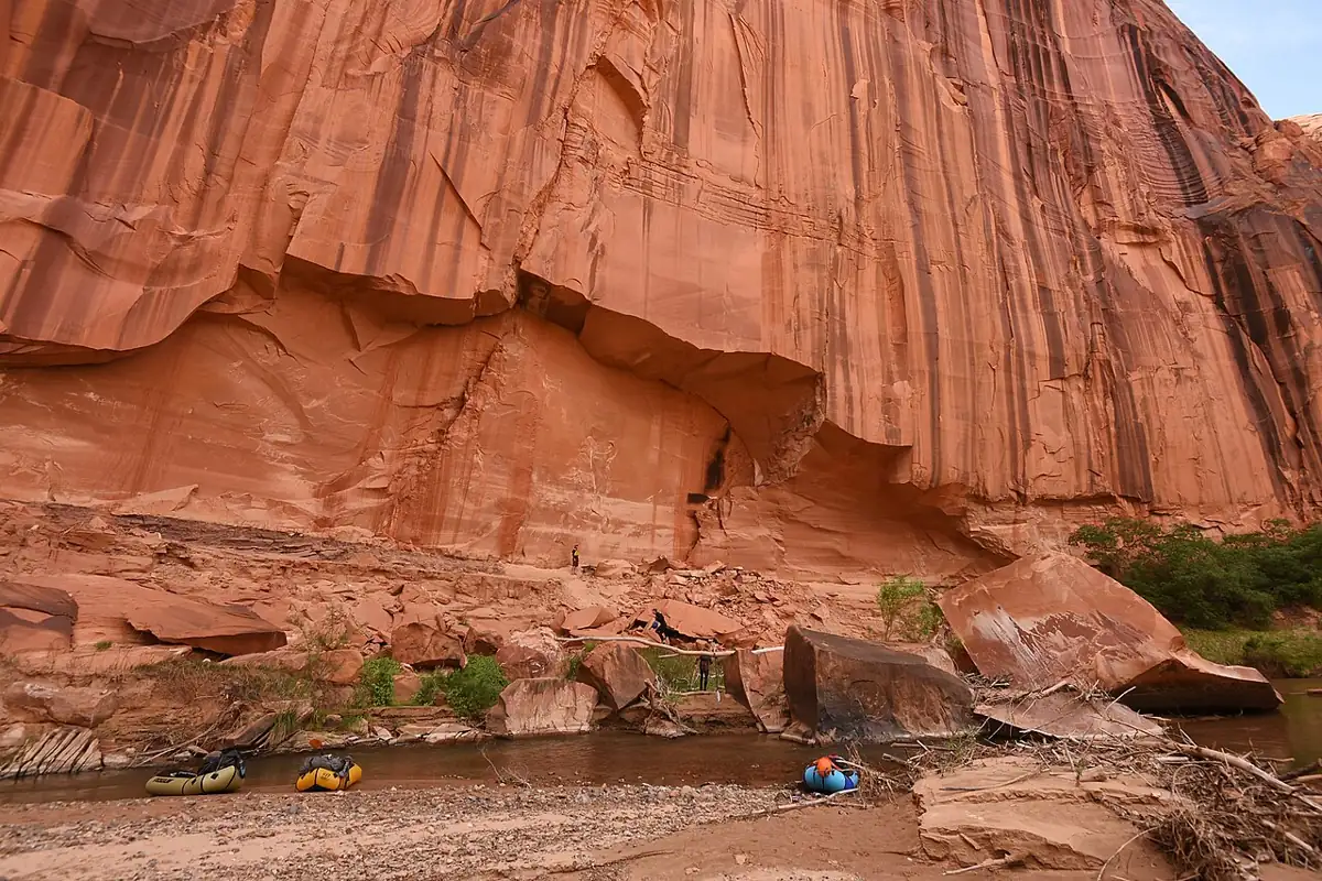
This is a trip for packrafters who are as comfortable walking as paddling. You will drag, line and portage, wade through mud, and finish with a steep climb out of the canyon with everything on your back. The canyon is narrow for days at a time, the side drainages hold arches and alcoves, and you may not see another group.
Route and access
The usual launch is the Escalante River Bridge Trailhead on Highway 12, about 14 miles east of the town of Escalante. Parking there is tight, so bring as few vehicles as you can and use the pull-out on the south side of the bridge to unload and rig. From the bridge the river winds roughly 76 to 82 miles to Lake Powell, with the exact figure depending on the reservoir level.
Mileage by reach
The NPS gives these approximate distances:
| Reach | Approx. miles | Notes |
|---|---|---|
| Highway 12 bridge to Boulder Creek | 6 | Warm-up miles near the road |
| Boulder Creek to The Gulch | 9.5 | Canyon deepens |
| The Gulch to Harris Wash | 14 | Harris Wash is a common hike-in start |
| Harris Wash to Twentyfive Mile Wash | 13 | Remote middle canyon |
| Twentyfive Mile Wash to Scorpion Gulch | 12.6 | Longer flat stretches |
| Scorpion Gulch to Coyote Gulch | 20.5 | Boulder jams, the hardest water |
| Coyote Gulch to Lake Powell | 6 to 8 | Mud and quicksand at low flows |
Few packrafters float all the way to the lake, because getting off the lower river means either a pre-arranged powerboat pickup on Lake Powell (a park concessionaire runs these from Bullfrog Marina) or a long hike out. Shorter trips that start or end in side canyons are possible with lightweight packrafts, which is how many groups fit the Escalante into a few days. In low-water years some skip the upper miles and hike in to start lower, for example via Fence Canyon.
The Coyote Gulch exit
The National Park Service says the most commonly used take-out is the confluence with Coyote Gulch. From there most groups climb out at Crack-in-the-Wall to the Fortymile Ridge Trailhead: about 3.5 miles, roughly 1,000 feet of gain, unmarked, and strenuous. The crack itself is too narrow for a full pack, so carry about 50 feet of webbing to haul packs through. Webbing does less damage to the sandstone than rope. Others walk out the length of Coyote Gulch toward Hurricane Wash, a longer but more gradual route. Either way, budget most of a day.
Shuttles run on Highway 12 and Hole-in-the-Rock Road, a long washboard dirt road that becomes slick and sometimes impassable after rain. Four-wheel drive is sometimes needed to reach Fortymile Ridge.
Flows and timing
The float window comes from spring snowmelt. The NPS says runoff can start any time from late March to early June, and the average date of high water since 1912 is around May 9. A big snow year can give up to two months of floatable water, an average year two or three weeks, and a dry year none at all.
Watch USGS gauge 09337500, Escalante River near Escalante, from March onward, alongside the snowpack reports for the Aquarius Plateau. The NPS recommends about 50 cfs for a float trip. Below that you push, pull and lift over bars and rocks for much of the day. Above it the trip goes faster, but boulder jams and swift bends get harder to manage. The guide to reading flows and gauges explains how to track a rising and falling hydrograph.
- From late winter, follow snowpack reports for the Escalante headwaters.
- In March, start checking gauge 09337500 daily.
- When the flow climbs toward 50 cfs and holds, confirm shuttles and the permit.
- Call the Escalante Interagency Visitor Center for current river and road conditions.
- Launch soon. Expect the level to drop day by day as you go.
Later in the year, thunderstorms can bring flash floods that turn the river brown and fast within an hour. Treat those as a hazard and stay off the river.
Hazards
- Boulder jams and rock fields, concentrated between Scorpion Gulch and Coyote Gulch. The NPS advises scouting the first jam, about a mile below Scorpion, preferably from the right bank, and portaging on the left at a chute about 9.5 miles below Scorpion.
- Brush and willow choke some reaches, which means dragging, lining and short portages. Overhanging limbs are a real eye hazard, so the NPS recommends helmets and glasses.
- Quicksand and deep mud are common, especially near side canyons and below Coyote Gulch where the lake has receded.
- Flash floods: if the river rises and turns muddy, get off it and climb to high ground with all your gear. Flood debris adds new strainers.
- The canyon is remote, with no cell service and slow rescue. Carry a satellite messenger.
- Wind on the lower river and the lake arm can stop a loaded packraft for hours.
The NPS rates the river Class II but recommends at least Class III skills because of the remoteness, the equipment risk and the few ways out. See river difficulty classes for what those labels mean in a small boat. Clip every dry bag to the boat and leave nothing loose, so a flip costs you a swim and not your gear.
Permits and rules
You need a free backcountry permit for any overnight stay in the Escalante District of Glen Canyon National Recreation Area and in Grand Staircase-Escalante National Monument. Get it from the Escalante Interagency Visitor Center in town or at an entry trailhead, and ask there about current conditions. The NPS page on floating the Escalante River is the official starting point.
| Rule | What it means for a packraft trip |
|---|---|
| Group size | 12 people maximum; larger parties split and stay half a mile apart |
| Human waste in Glen Canyon NRA | Carry out all solid waste in engineered waste bags; the boundary is about 3 miles below Horse Canyon |
| Human waste in the monument | Use a portable, self-contained system within 300 feet of any water |
| Fires | None anywhere in the river corridor or its side canyons |
| Pets | Leashed in Glen Canyon NRA, not allowed in Coyote Gulch |
| Trash | Pack out everything, including toilet paper and damaged gear |
A dry bag or a PVC "poop tube" works for carrying used bags in a packraft. The rules also ask you not to build cairns and to keep noise down.
Camping
Camp on sand or slickrock above the flood line, never in a side-canyon mouth. The side canyons hold arches, alcoves and archaeological sites; leave them as you found them, and follow the desert habits in the Leave No Trace guide. With no fires allowed, bring a stove and enough fuel for a week.
Packraft notes
- A light, open-deck boat works well. You will carry it a lot, so pick light weight over whitewater features. An ultralight packraft is ideal if your skills match the boulder jams.
- Use a durable floor or bring a floor patch kit, since you will drag over gravel and rocks. Know your field repair routine before you leave.
- Pack for a wet, sandy trip: quick-drying layers, gaiters, and river footwear that stays on in mud.
- Plan at least six days from the bridge to Coyote Gulch, plus the hike out.
- The hike-in and hike-out sections make this as much a canyon trip as a river trip. If that appeals, read about packrafting and canyoneering.
Who the Escalante suits
The Escalante suits experienced backpackers who already packraft and do not mind spending a third of their time on foot. You need solid moving-water skills for the jams, comfort with remote travel, and a flexible calendar, since the window opens and closes on short notice. Do a few easier multi-day floats before you try it.
For more canyon trips, go back to the Utah trip notes. Labyrinth Canyon is the easy flatwater alternative when the Escalante is too low, and the San Juan River runs reliably later into spring.
Escalante questions
What flow do I need to float the Escalante?
The NPS recommends about 50 cfs on gauge 09337500. Lower flows mean a lot of dragging; higher flows make the boulder jams harder.
Is the permit free?
The overnight backcountry permit for the Escalante is free. Pick it up at the Escalante Interagency Visitor Center or an entry trailhead.
Can I have a campfire?
No. Fires are prohibited throughout the river corridor and its tributaries, so bring a stove.
How do I get out at the bottom?
Most groups take out at Coyote Gulch and climb Crack-in-the-Wall to the Fortymile Ridge Trailhead. The alternative is a pre-arranged boat pickup on Lake Powell.
How many days should I plan?
At least six days from the Highway 12 bridge to Coyote Gulch, plus most of a day for the hike out.