Trip notes · Utah
Desolation and Gray Canyons of the Green River
Desolation and Gray Canyons make up one of the longest roadless river trips in Utah. The rapids come often and are rarely hard, which suits a confident packrafter carrying a week of food.
Last checked November 2026
Below the Uinta Basin, the Green River drops into a canyon that keeps getting deeper for days. Desolation Canyon comes first, cut through the Tavaputs Plateau with walls far taller than anything on the Labyrinth reach downstream. Gray Canyon follows, lower and more open, and ends at Swasey's boat ramp a short drive north of the town of Green River. The standard trip from Sand Wash to Swasey's is about 84 miles, and the BLM puts the average private trip at six to seven days.
For a packrafter, this is the usual next trip after a flatwater float. You run more than sixty rapids and riffles over a week, with no road access between the ends, while carrying everything you need in or on a boat that weighs less than your food bag. The individual rapids are within reach of a solid intermediate paddler. What wears people down is running them well on the sixth afternoon, with a heavy boat, in a group that has to sort out its own problems for days at a time.
Getting there
Sand Wash, the launch, sits at the end of a long dirt road south of Highway 40 in the Uinta Basin. There is a staffed BLM ranger station, a primitive ramp, vault toilets and eight primitive campsites for the night before, but no drinking water or trash service, so arrive with both handled. The road turns to slick clay when wet.
The take-out at Swasey's is near the town of Green River, which puts a long drive between the two ends. The BLM estimates four and a half to five hours one way through Nine Mile Canyon in good conditions, about three of them on twisting dirt roads. The route around on US 40 through Duchesne and Myton is a little longer but has only about an hour of dirt, and it is the better choice in wet weather. A self-run round-trip shuttle takes ten to twelve hours, so most private groups hire one of the shuttle companies the BLM lists. Sort out the shuttle when you book the permit.
Permit
The BLM Price Field Office requires a permit for all private and commercial trips, all year, and limits the number of launches per day. Apply on Recreation.gov. The BLM Desolation Gray permit page has the current calendar.
- Pick a launch window. May 1 to September 30 launches go through the lottery; dates outside that window can be reserved directly.
- Enter the lottery between December 1 and January 31. Each person may submit one application.
- Check results in mid-February and accept by the deadline in mid-March, or the date goes back into the pool.
- If you missed out, watch Recreation.gov for unclaimed dates and cancellations after the lottery closes.
- Plan a trip of three to nine calendar days, the range the stipulations allow.
- At Sand Wash, a ranger checks your permit, your photo ID and your required gear before you launch.
What the stipulations require
| Item | What the BLM asks for |
|---|---|
| Group size | 25 or fewer, no more than the number paid for |
| Toilet | washable, leak-proof, reusable system for carrying out solid waste |
| Fire pan | durable metal, at least 12 inches wide with a 1.5-inch lip, carried on every trip |
| PFD | Type I, III or V, rated for whitewater or paddling, one per person |
| Spare paddles | one for every one to three kayaks, IKs or canoes in the group |
| Repair and first aid | a repair kit for the boats on the trip, a pump, and a first-aid kit for serious injuries |
Read the toilet line carefully. The printed stipulations call for a washable, reusable system, which is stricter than the bag systems accepted on some other rivers, so confirm with the Price office whether your packraft-sized setup will pass inspection. All persons must wear a PFD from Jack Creek Rapid to the take-out, and children 12 and under wear one at all times. Groups must launch, travel and camp together, and you may not send a boat ahead to claim a camp. Do not camp or build fires on public land within half a mile of the mouth of Rock Creek.
The river
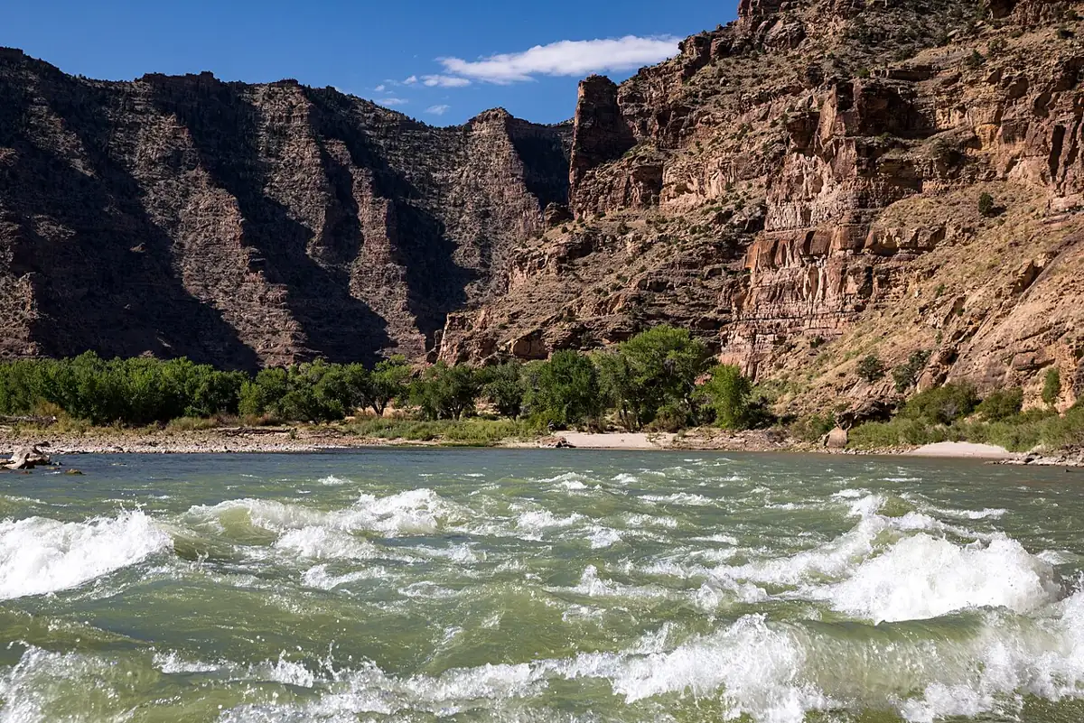
The first day below Sand Wash is flat, slow water, and the rapids start once the canyon walls close in. From there the river has dozens of named and unnamed rapids, mostly Class II wave trains and rock gardens with a few Class III spots that change with flow. The BLM describes some as challenging as Class III/IV at certain levels. Names you will hear include Steer Ridge, Wire Fence, Joe Hutch and Coal Creek. At higher water some become big wave trains with holes off to the side. At low water they turn into rocky picking.
Gray Canyon has the last of the bigger rapids in the final day or two before Swasey's. Most of them would be routine on a day trip, but there are a lot of them, and swims in cold spring water add up over a week. The page on river difficulty classes gives a fair idea of what Class III means in a packraft with a full load.
Skills you should have
- A reliable ferry and eddy turn in a loaded boat.
- Scouting from shore and choosing when to walk a rapid.
- A practiced self-rescue: getting back into a heavy boat in current, and helping someone else do it.
- Field repairs. A torn floor on day three is a long walk from anywhere, so know your packraft repair kit before the trip.
Flows and season
The Green here carries snowmelt from the Wind River and Uinta ranges, partly regulated by Flaming Gorge Dam. According to the BLM, it typically peaks around 20,000 cfs in late May or early June and drops below 3,000 cfs by late summer and fall. In extreme drought years it has run as low as 650 to 800 cfs and stayed navigable, which favors small, light boats like packrafts. The BLM points boaters to the Green River at Ouray and Green River at Green River gauges; read them the way the flows and gauges guide explains, and look at trip reports for the same level.
| Flow | Packraft character |
|---|---|
| Spring peak, well over 10,000 cfs | Fast, cold, brown water; big wave trains and holes; fewer beaches |
| Midsummer, falling | Warmer, friendlier rapids; the most popular window |
| Fall, under 3,000 cfs | Rocky rapids, slow pools, wide beaches |
| Winter | Ice can block the channel from December to March |
Late May through June is the busiest time, with the liveliest water. July and August are hot, with afternoon storms and flash floods in side canyons. September often brings the most settled weather. Avoid the winter months: ice forms across the main channel, and during breakup ice dams can block the braided reach between Nine Mile Creek and Lighthouse Rock.
Hazards
- Cold water and long swims during runoff. A drysuit or good layering matters in May and June.
- Heat and sun in midsummer, with little shade on the open beaches.
- Flash floods from side canyons during summer storms. Camp above them.
- Upstream wind in the open stretches of the first day and in Gray Canyon.
- Tamarisk and willow along the banks, which hide eddies and make poor landing spots.
- Black bears. The BLM asks groups to keep camps clean and food and trash secured on the boats.
Camping and history
Camps are sandy beaches and terraces, often near side canyons worth an afternoon walk, and they are first come, first served. Desolation Canyon is a National Historic Landmark, and you will pass Fremont rock art, granaries and old ranch sites. Leave artifacts where they lie. Carry and use your toilet system, keep fires in a pan, burn only driftwood, and keep soap out of side-canyon streams and springs.
Packraft notes
- A whitewater packraft with thigh straps and a spray deck or self-bailing floor is the right tool. See the notes on self-bailing packrafts for the trade-off in cold water.
- A week of food and water gear makes the boat heavy. Pack weight low and inside the tubes where possible, and practice rolling and self-rescue with the load before the trip.
- Wear a whitewater helmet in the rapids. Many are rocky at lower flows.
- Packrafters often join groups with a gear raft. A packraft-only trip is possible with a lean kit, since everything rides in or on your boat for a week.
Who the trip suits
Desolation-Gray suits packrafters who already run Class II comfortably, have done at least one multi-day river trip, and can handle a heavy boat in Class III water. A group of packrafts paired with one gear raft is the easiest way to manage the required toilet and fire pan. If you want a shorter first step with similar rapids, the Ruby-Horsethief stretch in Colorado or the upper San Juan make good warm-ups.
Back to the Utah trip overview. Downstream on the same river, Labyrinth Canyon is the flatwater counterpart, and the San Juan River is a shorter permit trip with milder rapids.
Desolation-Gray questions
Is Desolation-Gray too hard for a packraft?
No, for a paddler with solid Class II skills and some Class III experience. The rapids are many but rarely hard, and you can scout or walk the ones that look wrong.
When do I apply for a permit?
Lottery applications run from December 1 to January 31 for May through September launches. Dates outside that window can be reserved from December 1.
Can I bring my dog?
No. Pets are prohibited on the Desolation-Gray section year-round.
Can I camp on the left bank?
Not from Sand Wash to Coal Creek, which is Ute tribal land closed to all river users. Below Coal Creek Rapid you may camp on either side.
How long is the shuttle?
Four and a half to five hours each way through Nine Mile Canyon in good conditions, so most groups hire a shuttle service.