Trip notes · Arizona
Lower Salt River
The Lower Salt is the closest moving water to Phoenix. Whether it is worth floating on a given day depends on what the dam upstream releases, so check the gauge before you load the car.
Last checked November 2026
The Salt River leaves Saguaro Lake at Stewart Mountain Dam and runs west through Sonoran desert toward Mesa. The stretch below the dam, the Lower Salt, is managed by the Mesa Ranger District of the Tonto National Forest. The water is warm and the rapids are mild, so it suits a first outing in a new packraft or a day with a friend or dog who has never paddled. Don't confuse it with the Upper Salt, a Class III-IV canyon run far upstream with its own permit system.
Route overview
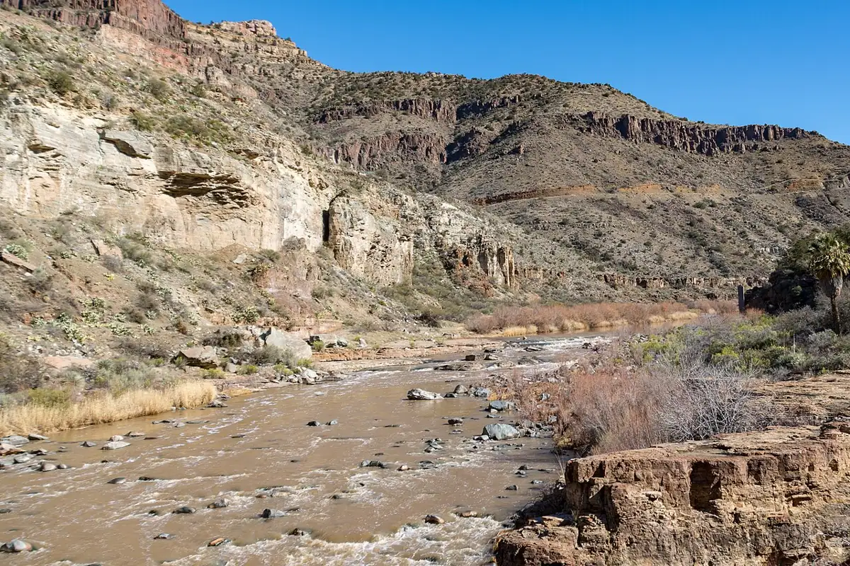
From the dam to Granite Reef Dam the river covers roughly 12 miles. The channel winds between low cliffs, mesquite bosque and cottonwood stands, with saguaros on the slopes above. Much of it is one long riffle with short pools between. Below Phon D. Sutton the Verde River joins from the north, and the flow picks up when the Verde is running. Granite Reef Dam is a diversion structure at the bottom of the run. Take out at the recreation site above it and stay well clear of the dam itself.
Access points
The main put-in is Water Users, a large day-use site just below the dam. Blue Point is a few miles downstream, and further down are Goldfield and Granite Reef. Phon D. Sutton, near the Verde River confluence above Granite Reef Dam, is day use only. Combining different pairs gives you anything from an hour on the water to most of a day. Bring two vehicles or a bike for the shuttle, because the river road is busy and parking fills early on summer weekends.
| Put-in to take-out | Approximate distance | Typical time on water |
|---|---|---|
| Water Users to Blue Point | a few miles | 1 to 2 hours |
| Water Users to Goldfield | about 6 miles | 2 to 4 hours |
| Blue Point to Coon Bluff | about 5 miles | 2 to 3 hours |
| Water Users to Granite Reef | about 12 miles | most of a day |
Distances are rough and times depend heavily on the release. At a low summer flow with a headwind, add an hour.
Most sites need a Tonto Pass displayed in the vehicle, and some accept federal interagency passes. Glass containers are banned throughout the Lower Salt River recreation area. Check current pass rules, gate hours and site closures with the forest before you go.
Flows
Salt River Project controls releases from Stewart Mountain Dam. Through the cooler months the release is often a trickle that leaves the river too thin to float. When SRP shifts its water delivery from the Verde to the Salt in spring, releases rise sharply and the river becomes a continuous riffle with a few stronger wave trains. Storms can also bring sudden higher releases. Check the USGS gauge below the dam (09502000) and SRP's announcements on the morning of your float, and see river flows and gauges if you are new to reading them.
Local paddlers usually put the bottom of the floatable range at a few hundred cfs, and below that you will be dragging the boat over gravel bars. Summer releases are usually comfortable for a packraft, and the river only turns serious during storm releases, when brush on the banks becomes a real hazard.
- The evening before, check the gauge trend and any SRP release notice.
- Look at the Tonto National Forest alerts page for closures, including eagle-nesting areas.
- Stage a vehicle or bike at the take-out first, so you finish where your shuttle is.
- Inflate fully at the put-in and top off the tubes after ten minutes in the water.
- Note the time and keep an eye on it; afternoon heat builds fast on the desert reaches.
Hazards
- Strainers and low branches sit on tight bends, more so at higher releases.
- Summer air temperatures in the desert can be dangerous. Carry more water than you think you need and wear a sun shirt.
- On hot weekends, rental tubes form floating traffic jams. Packrafts are faster, so pass with care and do not ram tubers.
- Broken glass and trash collect at popular eddies. Wear shoes with real soles. The footwear page covers options.
- Car break-ins happen at busy trailheads. Leave nothing visible in the vehicle.
Wear a life jacket even here. People get into trouble on easy rivers when they try to stand up in moving water and find the current stronger than it looked, or catch a foot between rocks. The life jacket guide covers fit for packrafting.
Wild horses and wildlife
The Salt River horses graze along the banks and often wade the river. Give them plenty of room and never paddle between a foal and its band. You will also see herons and bald eagles in the cottonwoods. Some sections have seasonal eagle-nesting closures, posted by the forest, and they apply to boaters as well as people on foot.
Season by season
| Season | What to expect |
|---|---|
| Winter | Releases often too low; cool, pleasant air if there is water |
| Spring | Releases rise as SRP shifts to the Salt; mild air, fewer crowds |
| Summer | Reliable water, very hot air, heavy weekend tubing traffic |
| Fall | Releases drop off; quieter weekdays, warm afternoons |
If the release is up, a weekday morning in late spring gives you mild air and an empty river.
Common mistakes
- Driving out without checking the release, then finding a rock garden where the river should be.
- Parking without a pass, or with an expired one, and coming back to a ticket.
- Starting at noon in July. By mid-afternoon the air off the rocks feels like an oven.
- Underinflating to "soften" the ride. A soft boat folds on rocks and scrapes the floor on every riffle; the inflation guide explains how firm to go.
- Tying a dog leash or a throw bag loose in the boat, where it can snag a branch or a leg in a flip.
Camping
The Lower Salt is mostly a day-use corridor, and the river recreation sites do not allow overnight camping; check the forest's current rules if you want to stay nearby. If you want a multi-day float, look further afield: the Grand Canyon or the cold, clear reach below Glen Canyon Dam both allow camping with the right permits.
Skill level and who it suits
This is a good first river for anyone who has paddled flatwater and read the packrafting primer. You need to steer around bends, ferry away from brush and climb back in from shallow water. A first-timer with a steady friend will be fine at normal summer flows. It also works for a dog's first float, as long as the dog wears its own life jacket and you watch the paws on hot rocks; the dog packrafting notes cover the details.
Packraft notes
Any packraft works here, including lightweight lake boats. A spray deck is optional in summer. Inflate fully because the water is warm and shallow riffles will scrape a soft boat. Pack out everything, including tube patches and snack wrappers, and follow Leave No Trace habits on a river that receives a lot of visitors. For the other Arizona options, see the Arizona overview.
Do I need a permit to packraft the Lower Salt?
There is no river permit. You do need a Tonto Pass displayed in your vehicle at most recreation sites, and some sites accept interagency passes.
What flow do I need?
Check USGS 09502000 below Stewart Mountain Dam. Most paddlers want at least a few hundred cfs; winter releases are often lower than that.
Can I camp along the river?
The river recreation sites are day use. Look up the Tonto National Forest's current camping options away from the river corridor.
Is it safe for a complete beginner?
At normal summer flows it is one of the easiest rivers in the region, but strainers on the bends are real. Go with someone experienced and wear a life jacket.
Are the horses dangerous?
They are wild animals. Keep your distance, do not feed them and never paddle between a mare and foal.