Trip notes · Texas
Rio Grande: the Lower Canyons
The Lower Canyons are among the most remote river trips in the lower 48, and one of the few you can float in the middle of winter. Plan for a week or more with no road access at all.
Last checked November 2026
Downstream of Big Bend National Park, the Rio Grande cuts through a series of limestone canyons along the Texas-Mexico border. This stretch, the Lower Canyons, is part of the Rio Grande Wild and Scenic River and is managed by the National Park Service from Big Bend. No roads reach the river along the way, so once you launch the only practical exit is downstream. The NPS puts the trip at 83 miles and 7 to 10 days, and that range is realistic for a packraft once you add wind days and side hikes.
Route overview
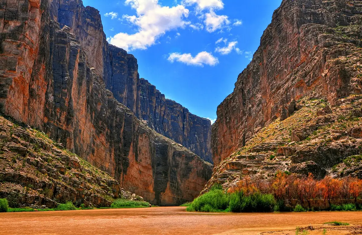
The trip starts at Heath Canyon, on the US bank just below the La Linda bridge, east of the national park. The first stretch runs through open desert and low hills, with wide gravel bars and big skies. The canyon walls build gradually, and by the middle of the trip they rise well over a thousand feet. Below the canyons the country opens again for the last miles to Dryden Crossing.
There is a secondary put-in at Maravillas Canyon in the Black Gap Wildlife Management Area, about 10 miles downstream of Heath Canyon. Texas Parks and Wildlife manages that land; it charges a per-person fee and closes river access during deer season, so check before you plan around it.
| Stretch | Rough character | What to expect in a packraft |
|---|---|---|
| Heath Canyon to the first canyons | Open desert, braided gravel | Slow current, wind exposure, easy camps |
| Middle canyons | Walls over 1,000 ft, springs, side canyons | Most of the rapids, best hiking, shaded camps |
| Lower canyons and exit | Walls fall back, river widens | Long flat paddling days, then the take-out |
Permits and shuttle
The NPS requires a backcountry use permit for any overnight trip on the Wild and Scenic River below the park, and every Lower Canyons party must complete and sign the park's Assumption of Risk and Release form when the permit is issued. Get the permit at a Big Bend visitor center and confirm the current hours and locations with the park before you drive in, since they have shifted over the years.
The take-out at Dryden Crossing is on private land. The NPS asks every individual or group to submit a take-out request to the landowner in advance to use the access there. The drive between put-in and take-out goes far around on back roads, so most parties hire a shuttle driver or stage vehicles in advance. Budget a full day each way for car shuffling.
- Pick dates, then check the gauge trend and the park's river information.
- Arrange the shuttle and submit the Dryden Crossing take-out request.
- Pick up the NPS backcountry use permit in person and sign the release form.
- If you plan to use the Maravillas access, buy the Texas Parks and Wildlife permit it requires.
- Leave a float plan with someone at home, including your expected take-out day and a late-by day.
Required gear under park rules
The park's river regulations apply to packrafts the same as to rafts and canoes. Read the full list on the NPS site before you pack, but the core requirements for an overnight Lower Canyons trip are:
- A properly fitted, USCG-approved life jacket for everyone, worn in Class II and harder water. The group carries one spare. See choosing a life jacket for packraft-friendly cuts.
- A spare paddle per boat. Kayak-style parties may carry one spare per group, but a four-piece spare is light enough that most packrafters carry their own.
- A human-waste system for overnight groups, such as bagged personal kits.
- A fire pan with at least a 2-inch rim if you plan any fire, with all unburned charcoal carried out.
- A patch kit and a pump for inflatable boats in the major canyons. Bring a proper field repair kit with patches and adhesive.
Group size is capped at 20 for private parties in the Lower Canyons. Pets are not allowed in the backcountry. The permit does not allow you to enter Mexico, and possessing firearms or ammunition is a felony in Mexico, including in Mexican waters.
Best season and flows
Late fall through early spring is the window. Summer heat in the canyons is severe, and summer storms can flash-flood side drainages. Winter days are often mild and sunny, while nights drop below freezing.
Flows are low for much of the year because the river is heavily used upstream. Most of the Lower Canyons' water comes from the Río Conchos in Mexico and from springs inside the canyons themselves. The NPS says 200 cfs or more is enough for canoes and smaller paddle craft, and around 400 cfs is the usual minimum for rafts. A packraft fits in the small-boat group. At the low end expect to drag across gravel riffles in the upper miles; the springs add water as you go down.
Paddlers usually watch the Rio Grande Village gauge in the park and the readings near Dryden. Some readings for this stretch are published by the International Boundary and Water Commission in cubic meters per second; multiply by 35.3 to get cfs. The gauges guide explains how to read a trend rather than a single number. A rising river after rain in Mexico can change the trip in a day.
Rapids and hazards
Most of the 83 miles is flat or gently moving. The NPS rates the run Class II-IV overall. The rapids that matter cluster in the middle canyons:
- Hot Springs Rapid is a lively Class III, and the warm springs beside it make a good stop.
- Upper Madison Falls is usually considered the hardest drop. Many parties scout it, then line or carry. The portage path is steep and overgrown with cane.
- Several smaller rapids are rocky at low water. In a loaded packraft, the hazard is wrapping on a midstream rock or tearing a tube on limestone.
Other hazards are less obvious. Cane along the banks hides the shoreline and makes scouting slow. Upstream winds can stop forward progress for hours. Help is many hours or days away, and cell coverage is mostly absent, so a satellite messenger is standard.
The border
The river is the international boundary for the whole trip. Camp on the US bank. The NPS notes that illegal crossings occasionally happen in the corridor. If you see one, do not approach or intervene: note the location, time, a description and direction of travel, and report it when you can reach a phone. Carry identification on the trip.
What a winter week looks like
A typical party launches at Heath Canyon in the morning after a long drive and a day of car shuffling. The first nights are spent on open desert flats with frost on sleeping bags at dawn. By the third or fourth day the canyons close in, and most days follow a pattern. You break camp once the sun reaches the river, paddle around ten miles with a lunch stop in the shade of a side canyon, and camp early enough to hike. Wildlife commonly seen includes mule deer, bighorn sheep, javelina, coyotes and many turtles.
Expect at least one day where a headwind makes ten miles feel like twenty. Build in one or two spare days so the take-out date is not forced.
Logistics and camping
- The nearest airports are hours away. Most paddlers drive in, and the shuttle often takes as much planning as the river.
- Gravel bars and terraces make easy camps in the upper half. In the canyons, pick sites above the high-water line and away from side drainages if there is any chance of rain. Follow Leave No Trace practices: pack out waste, use the fire pan, keep camps small.
- Winter days can be warm, and nights often drop below freezing. Bring a warm sleeping bag and a layer you can paddle in. See layering for cold water.
- Any packraft that tracks well will do. Long flat days favor a longer hull and a good touring paddle. A spray deck is optional; it helps more with wind chop than with the rapids.
- With 7 to 10 days of food plus water capacity, boats get heavy. Practice paddling loaded before the trip and keep weight low and centered.
Use the packraft packing checklist as a base, then add the park-required items above.
Skill level and who it suits
You should be comfortable with multi-day self-support and solid Class II-III before you go. The whitewater is moderate, but there are no road exits and help is slow to arrive. Small groups with desert camping experience tend to enjoy it most, especially paddlers who want a winter river trip and don't mind long, quiet days at the paddle. If your group has not done a multi-day float yet, start with something shorter and closer to a road; the trip planning article walks through how to scale up.
Do I need a permit to packraft the Lower Canyons?
Yes. The NPS requires a backcountry use permit for every overnight trip on the Rio Grande Wild and Scenic River, and you sign a release form when it is issued.
How long does the trip take?
The NPS says 7 to 10 days for the 83 miles from Heath Canyon to Dryden Crossing. Wind and low water slow packrafts more than larger boats, so plan for the longer end.
Can I camp on the Mexican side?
The park permit does not authorize entry into Mexico. Camp on the US bank and check current border guidance with the park before you launch.
What flow do I need for a packraft?
The NPS treats 200 cfs and up as enough for small paddle craft. Below that, expect dragging in the upper miles until springs add water.
Is the water safe to drink?
Not untreated. The river carries agricultural and municipal runoff, so filter and treat everything and refill at springs where you can.
The trip is a good winter counterpart to summer runs like the Rogue or the flatwater of Grand Teton. For desert canyon trips closer to the Rockies, see the Utah section. Other destinations are on the further afield overview.