Trip notes · Montana
Montana's Bob Marshall Wilderness
The Bob Marshall is one of the largest roadless areas in the lower 48. Packrafters on the South Fork of the Flathead spend days walking to the headwaters before they float back out.
Last checked November 2026
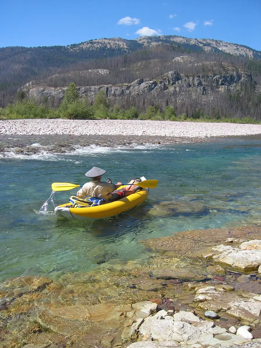
The South Fork of the Flathead River starts deep in the Bob Marshall Wilderness, where Youngs Creek and Danaher Creek meet, and flows north through a long, roadless valley toward Spotted Bear and Hungry Horse Reservoir. You cannot drive to the upper river. Packrafters reach it by hiking over a pass or along the river trail, sometimes for 20 or 30 miles, then float back toward the trailheads near Spotted Bear. The water is clear enough to watch trout from the boat, and gravel bars make easy camps.
The Forest Service classifies the South Fork as a Wild river for 51.3 miles from the Youngs and Danaher confluence to the Spotted Bear Ranger Station. Almost all of that lies inside the wilderness, so motors, bikes and wheeled carts stay out.
Route shape
Most trips start from a trailhead on the east or west side of the wilderness and cross a pass to the headwaters. Others walk up the river trail from the north and float back down the same valley. On a walk-up trip you see the river you are about to float, which helps you plan camps and spot logjams. Trips commonly take a week. Food, camping gear, boats and fishing tackle make for heavy packs on the first days.
Above Spotted Bear the river enters Meadow Creek Gorge, a narrow, committing canyon rated Class IV-V. Most packrafters deflate above it and walk the trail around it. Unless you are an expert who has seen it at a known flow, plan to walk.
Common ways to put a trip together
| Plan | Approach | Float | Notes |
|---|---|---|---|
| Over a western pass | A trailhead on the Swan Valley side, over the Swan Range | Headwaters to the Meadow Creek area | Long climb with a full pack, then the whole wild section |
| Over an eastern pass | Trailheads on the Rocky Mountain Front, across the Continental Divide | Headwaters downstream | Longest approach; big country and few people |
| Walk up, float down | River trail from the Spotted Bear end | Same valley back down | No car shuttle; you scout the river on the way in |
Whichever plan you pick, get the current trail and fire information from the Spotted Bear Ranger District first. Trails cross burned areas where downed timber can make miles very slow.
Mileage and time
American Whitewater lists the run from Youngs Creek to Mid Creek at about 37 miles of Class II+. A loaded packraft covers that in two to four days, depending on flow, fishing time and logjams. The walk in often takes as long as the float. Allow one spare day for weather or for a portage that takes longer than planned.
What the river is like
The upper miles below the confluence are small and braided. Channel-spanning logjams are common, and you may need to walk short distances across gravel bars to get around them. The Forest Service river guide warns about logjams in this stretch. Youngs Creek above the confluence can be floated in early summer but is rated Class IV with narrow rocky channels, so most people start on the main river.
Lower down, the South Fork gathers tributaries and becomes a clear, green river of riffles, pools and short Class II rapids. Wood is the main hazard at any flow. Use the river classes guide to compare ratings, but expect the difficulty here to come from strainers more than from waves. Practice swimming to shore and reentering your boat before the trip; a loaded packraft is harder to climb back into than an empty one.
Best season and flows
The float season is roughly mid-June through late August. In late May and early June, snowmelt runoff is high, cold and pushy, with logs moving down the channel. By midsummer the river drops to friendly levels for loaded boats. By late August some riffles get shallow, and you will drag a bit in the upper miles.
The USGS gauge on the South Fork above Twin Creek, below Spotted Bear, gives a trend for the whole river even though it sits downstream of the wilderness. Watch how fast it is dropping, since a hot week or a rainstorm can change it quickly. The flows and gauges guide explains how to use a gauge that is downstream of your float.
Rules and agency
The South Fork and the Bob Marshall are managed by the Flathead National Forest through the Spotted Bear Ranger District. The forest publishes South Fork river regulations and Bob Marshall Wilderness regulations on its alerts page. The rules most likely to affect a packraft party:
- Check the group size limit for the wilderness section. Forest guides list 15 people per group and 35 head of stock.
- Follow the forest's food and attractant storage order for grizzly country. Hang food, use a bear-resistant container, or store it as the order allows.
- Check current fire restrictions and area closures before you leave and again at the trailhead.
- Keep wheeled carts and motors out of the wilderness, and use only certified weed-free feed if you bring stock.
- Pack out all trash and follow wilderness camping practices on gravel bars.
Rules change, and new river management plans have been proposed for the Flathead's forks in recent years. Read the current South Fork regulations before every trip.
Bears, fishing and other hazards
This is grizzly country. Carry bear spray where you can reach it while walking and paddling, cook away from camp, and store food under the forest order. Gravel bars give good sight lines; camp where you can see what is coming.
The South Fork is known for westslope cutthroat trout. Montana fishing licenses and regulations apply, and bull trout in the drainage are protected, so read the current Montana Fish, Wildlife and Parks rules for the South Fork before you fish. The packraft fishing article covers rod carry and rigging.
Other hazards include cold water in early summer, lightning on open passes, and long river fords on some approach trails. Footwear that handles both trail miles and wet crossings matters; the river footwear guide compares options.
A trip cut short by fire
One party that walked about thirty miles up the South Fork and floated for three days had a quiet trip until the last afternoon, when a smoke column they had been watching grew much larger. Late that night a Forest Service ranger walked into their camp: a nearby wildfire had grown from tens of acres to thousands in a few hours and was about six miles away. They packed up and hiked back upriver by headlamp to the ranger's cabin. The next day smoke ruled out a helicopter pickup and the fire was reported near their planned exit, so the only way out was a 30-mile walk over a high pass to the west, done in one long day.
Logistics and gear
- Trailheads are far apart, and shuttles between the east and west sides are long drives. Walk-up, float-down plans avoid the shuttle.
- Choose a light boat and paddle for the walk in; the packing list helps you trim. A four-piece touring paddle packs inside the pack instead of snagging on brush.
- Pack food and sleeping bag in proper dry bags for the float. Afternoon storms soak anything left on the bow.
- Montana licenses and regulations apply. If you fish, plan the rod tube into your pack system before you leave home.
- Camps are easy to find on gravel bars and benches along the river.
Skill level and who it suits
The paddling is moderate, mostly Class I-II with wood hazards. What makes the trip hard is the distance from help, along with bears, weather and fire. It is best for fit backpackers who already paddle moving water with confidence, and it is an obvious choice for anglers who want a week on clear trout water. First-time packrafters should get some moving-water days on easier rivers before carrying a boat this far.
Do I need a permit to packraft the South Fork Flathead?
Private float parties are not commonly required to carry a float permit, but wilderness regulations, group size limits and the food storage order apply. Confirm current rules with the Flathead National Forest.
How far is the float?
About 37 miles from Youngs Creek to Mid Creek, inside a Wild river section the Forest Service lists at 51.3 miles.
Should I run Meadow Creek Gorge?
Only if you are an expert who knows it at the current flow. It is rated Class IV-V, and most packrafters walk the trail around it.
When is the best time to go?
Mid-June through late August. Earlier, runoff is high and cold; later, the upper riffles get shallow.
What happens if a fire starts during my trip?
Follow ranger instructions, use your satellite messenger, and be ready to walk out by an alternate route. Know at least one exit besides the one you planned.
For other hike-and-float trips, see Alaska's Aniakchak and the Nahanni. The road-accessible lakes of Grand Teton are an easier warm-up. Back to further afield.